April 27, 2011

Harpers Ferry National Historical Park, West Virginia


Located at the confluence of the Shendandoah and Potomac Rivers, where a sliver of West Virginia meets Maryland and Virginia, Harpers Ferry is a town steeped in human and geologic history. First settled in 1750 and the town established in 1763, Harpers Ferry served a strategic role in the expansion of settlement, commerce, war, and peace for centuries.

The Armory

Harpers Ferry was visited by George Washington as part of a movement to establish a series of canals on the various rapids of the Potomac to improve trade and commerce with the burgeoning Ohio Valley. In 1794, Washington established an armory at the site. It was a great strategic location because it was far enough inland to avoid attacks from sea, while guns and munitions produced there could easily be floated downstream to the Chesapeake Bay.

Downtown Harpers Ferry, WV

Harpers Ferry is probably best remembered as the site of John Brown's Raid in 1859. This violent abolitionist decided to attack the armory, take the weapons, and distribute them to slaves across the south to create a giant slave revolt. Well, it didn't work out very well for John Brown. Actually, the raid was going great at first, as it caught everyone by surprise. Then a train rolled through town. They captured the train, but when a freed former-slave baggage handler confronted them, he was shot. For some reason, John Brown then decided to let the train leave again.

Harpers Ferry from the ridgeline

Thus, when the train got to its next station, they informed the authorities and it wasn't long before the Army descended on the town. After a couple of days of being holed up at the armory, Brown was offered the chance to surrender, which he refused. Then the army troops raided the armory, killing or capturing all of Brown's men. John Brown himself was stabbed with a saber and arrested. He was later tried, convicted, and hung for his actions.

The old C and O Canal (filled with algae)

What made the raid so important though was the press it recieved. It really highlighted the means by which some people were willing to go to end slavery. While John Brown may have been extreme, perhaps insane, it did motivate a lot of people as the Civil War approached.

The view downstream from Jefferson's Rock
Thomas Jefferson stood here!

Harpers Ferry was also a major strategic location during the Civil War. As a place where both rail and canals allowed commerce and trade through the mountains, Harpers Ferry changed hands several times through the war with the Union and Confederacy constantly swapping control. Harpers Ferry also served as a significant in the post-Civil War era as the location of Storer College, one of the first Historically Black Colleges that was run from 1865 to 1955. It was a place to teach "freedmen" and teachers. Today, it is part of Harpers Ferry National Historic Park.

The rapids along this stretch are very popular with tubers in summer

Harpers Ferry is also the headquarters of the National Park Service's Interpretation Division. Just about every NPS brochure you pick up at a national park, film you watch at the visitor center, or poster you see on the wall was produced at Harpers Ferry. When a national park wants to create some interpretive display or program, professionals from Harpers Ferry come out to inspect, advise, and document what is happening and often take it back with them to produce it there.

Looking downstream toward the piedmont

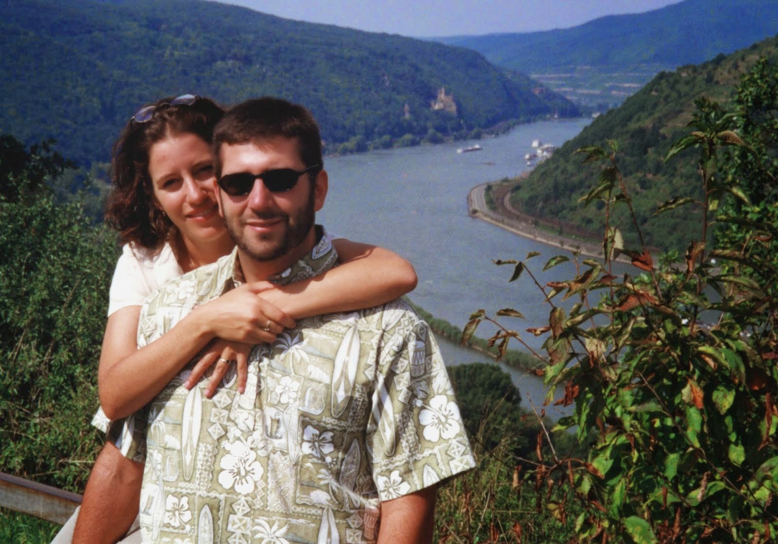
Geologically, Harpers Ferry is also very interesting. Typically rivers in these parts of the Appalacians meanders down the lengths of the valleys. Typically the valleys formed where softer sedimentary rocks were more easily eroded. But, since the ridges are made of harder, more resistant materials, rivers can not cut across them and just follow the valley.

Aerial: Harpers Ferry and the confluence is in the upper right
Notice the Valley and Ridge arrangement with the Potomac cutting right across

So, how did the Potomac/Shenandoah Rivers cut perpendicularly across these ridges? How did any of these so called "water gaps" form? There are two theories and both may be true in certain instances. One of them is that the rivers are so ancient that they may actually pre-date the Appalachains (that's 420 million years!). In that case, they may have been able to maintain their course and erode through the ridges at the same rate they were rising up. That is almost certainly the case for rivers in younger landscapes such as the Columbia River through the Cascades or the Colorado River across the Kaibab Uplift. But, to be as old as the Appalachians would make these among the oldest rivers on Earth!

A water gap in Pennsylvania from the airplane

The other more likely scenario for these rivers is that drainages (hollows) along fault lines on the outside of the ridges allowed streams to cut into the ridge. As a gap began to form in the ridge, eventually it cut down into the opposite valley and then captured a pre-existing river that was following the valley parallel to the ridges. This stream capture event then allowed the entire river to change course and cut perpendicular to the ridges and out to sea.

April 21, 2011

Great Falls Park and C & O Canal NHP, Virginia/Maryland


Located just a stones throw away from Washington D.C. are an unexpected gem of natural beauty. Located within the rocky Mather Gorge, Great Falls are a series of waterfalls on the Potomac River with a total drop of 76 feet over a 1 mile distance. What makes Great Falls all the more spectacular is the sheer volume of water carried by the Potomac River, as well as, the numerous channels the river has carved into the bedrock.

One of numerous side channels through the rocks

Up on the exposed bedrock terraces, some unique assemblages of plants occur. That is because the exposed rock does not hold moisture and contains little soil, for the plants that live on them it is almost like an arid climate. Thus, you will find species not common to the region, such as midwestern prairie plants and boreal tree species from further north.

The Terrace Forest

The river branches into many individual channels cutting through the rocks, leaving many rocky islands. The number of individual cascades and falls are practically uncountable, and change regularly with changes in flows.


The falls were certainly a major navigational hazard in the early days of colonization. George Washington was a major proponent of developing a way for commerce to head up the Potomac into the Appalachians and the vast interior. Thus, in 1785, the Potowmack Company began construction of small canal segments to circumvent the various falls and rapids on the river. Getting barges down the river from Cumberland, MD to Washington became fairly easy. But, getting those barges back up stream was more difficult. In fact, the only way to do it was to push them with poles against the current in a very slow and arduous journey.

One of the locks on the C & O Canal

In 1824, the Chesapeake and Ohio Company began work on the C and O Canal. They hired the former engineer of the Erie Canal to design it. They wanted to build a canal that would connect the Ohio River Valley with Chesapeake Bay. This would allow commerce to move across the entire United States from the Chesapeake Bay and eastern seaboard up to the Ohio River Valley, and down Mississippi River all the way down to New Orleans.

Great Falls Tavern was built in 1831 to service and lodge workers on the canal
Today it is the NPS Visitor Center for the park

The canal ended up connecting Georgetown in Washington, D.C. to Cumberland, MD and traversed 184 miles. It did not end up going all the way to the Ohio River due to the cost and technical issues of crossing the eastern Continental Divide. By 1836, the canal was operating full speed with 74 locks. Barges would drift downstream and mules would pull the barges back upstream using the towpath trail that paralleled the canal.

One of the old wooden locks

 Its enormous initial success however, was short-lived because the Baltimore and Ohio Railroad, that paralleled the same route, was finished in 1837 and that greatly reduced the need for the canal. However, the canal was still used to barge coal downstream from the Allegany Mountains until 1924. Generally, it did not make economic sense to haul stuff upstream, so empty barges were just pulled back up to the coal mines.

Mules along the tow path pulling barges upstream

The federal government wanted to make the C and O Canal and towpath a recreation area as early as 1938, but war and difficult finances put off those projects and the canal went into disrepair. In 1954, Supreme Court Justice William O. Douglas, an avid hiker and outdoorsman, led the charge to protect it as a national park. Finally, in 1971, the C and O Canal was preserved as a National Historic Park.

A historic barge you can ride from Georgetown


A Park Service Ranger in traditional garb

Today, you can hike or bike the entire 184 miles including nice sections through Georgetown, Great Falls Park, and Harpers Ferry NHP.  The C and O Canal is very popular with bikers and joggers and recieves over 3 million visits per year. In addition, there are a couple of places where you can take an authentic barge ride, for instance in Georgetown, where national park rangers dress in historic era clothing and play the music of the day on their bangoes.

Great Falls and the Potomac River from the air

April 17, 2011

Virginia - Shenandoah National Park


Shenandoah National Park, located in the Blue Ridge Mountains of northwestern Virginia, is one of the most famous national parks in the nation. That is probably because it is located just a couple hours drive west of the heavily populated Washington DC-Baltimore area, and just a day's drive from the even more heavily populated New York-Philadelphia megalopolis better known as New Jersey.

Early morning view from the 4,000 foot Hawksbill (highest peak in Shenandoah)

Located on the eastern edge of the middle portions of the Appalachian Range, it is also the highest ridge in the amazing series of folds that make up these mountains. Formed by the collision of North America and Africa, some 450 million years ago, these mountains once rose to Himalayan-like heights of over 20,000 feet! When a rift formed, separating North America, Africa, and Europe, it torn the mountains apart, leaving parts of the Appalachians in Africa (Atlas Mountains in Morocco) and parts of it in Europe (Scottish Highlands). Today, what we see in its peaks and troughs are just the core rocks that folded under the immense pressures of continental collisions.

A series of ridges and valleys in the Appalachians from the air

Shenandoah National Park protects a beautiful stretch of Eastern Deciduous Forests. The diversity of these forests is outstanding, consisting of white oak, hickory, elm, maple, and tulip poplars. Of course, it wasn't always this case. This entire park was clear cut in the 1800's and in 1935, when the park was established, much of it was still barren, while the rest was relatively young second growth.

Oak-Hickory Forest

As much of the land was denuded in the late 1800's and early 1900's, timber and game became scarce and it was difficult to successfully farm in the uplands. Thus, much of it was abandoned. Slowly, the state of Virginia began to reacquire the vacant land. Eventually, in 1926 Congress authorized the creation of Shenandoah National Park. However, there were still about 500 people living within its boundaries, so over a period of 9 years people where either bought out, forced to move, or allowed to stay until they died. By 1935 the park was fully established. Today, it is the ecological gem of the Mid-Atlantic Region!


While the forests recovered quickly with protection from saw and plow, one element of this forest never recovered. Chestnut-blight, brought to the U.S. in 1900, had completely devastated the American chestnut in Shenandoah even before the park was established. It is estimated that chestnuts once composed over 40% of the trees in the forests of the mid-Atlantic and were also among the tallest and largest of all trees in this region. Thus, to lose that component of these forests was a major impact.

American chestnut sprouts from a dead stump
The saplings from previous resprouts have already succumbed to the blight

But, what shocked me when I started hiking around Shenandoah is that the American chestnut still lives in the park. Most of them are very small and generally you find them as sprouts coming out of the base of huge stumps. Apparently, the blight only kills the chestnuts when they reach reproductive age and the dead trunks and roots are pretty resilient. So, after the main stem dies, it will resprout, grow up to a small tree size and then immediately upon producing its first flowers and nuts is reinfected with the blight. Thus, many of the root masses are hundreds of years old, have resprouted numerous times, but still produce virtually no offspring. One wonders how long they can keep it up...

Dead eastern hemlocks in Dark Hollow

Beyond the chestnut, the forests of Shenandoah are not completely safe. The stands of Eastern hemlock, so common in wet protected drainages in the east, are under assault. In this case, it isn't a fungus, but an insect. The woolly adelgid is a scale insect, introduced from Asia in 1924, that sucks the sugary phloem out of new needles of hemlock trees. While the tree can survive a few years of this, eventually they simply can not get enough nutrients to their roots and die off. All over Shenandoah, and across the east, hemlock stands stand as open skeletons of once lush, dark canyon bottoms.

Cascades within Dark Hollow

Anyways, when visiting Shenandoah, a must see place is Dark Hollow Falls. There is an excellent relatively short loop hike that will take you from the upland deciduous forests, down into the hollow (an eastern name for narrow drainage), following the creek and then loops back up to a set of nice waterfalls. This hike leaves from Byrd Visitor Center off the Skyline Drive.

Dark Hollow Falls from above

When we were at Shenandoah, it was a heatwave of 105 degrees down in DC and into the 90's and humid at 4000 feet elevation. So, to be able to descend into the cool shade of the hollow and then take a dip in one of the pools was a nice relief.

Cooling off on a hot and humid day

Early in the morning is an excellent time to drive up onto Skyline Drive to get a panoramic view of the Appalachians. Mornings tend to have the least haze, as the updrafts have not yet begun to bring water vapor, dust, and pollution to higher elevations. But, nonetheless, even at 6am the skies were hazy in July.


But, the condensation clouds and haze did make for some beautiful sunsets at our campsite at Lewis Mountain.


April 14, 2011

A New Series; Our National Parks


The other day I was thinking to myself, man, I have been to over 170 national parks in the United States. That is pretty amazing! Granted, there are nearly 400 of them, but still, 170 is a big number.

I've never had a goal of being a "lister" and traveling to every single national park unit in the country. Logistically that is extremely difficult, especially when you consider some of them are in places like Guam, American Samoa, northern Alaska, and the Aleutian Islands. In addition, they are always making new ones, so just after I had swept through an area, they'll probably make a new one.


I do however, have a goal of see as many as I can reasonably get to. So, I started thinking to myself, wouldn't that be a cool series for this blog to highlight many of the park I have gone to?


I've covered many of them already in this blog. A list of those posts is now available on the sidebar. Soon, I'll start thinking other ones to focus on, with an emphasis on the hidden gems or must see destinations, and I'll post one per week from now on. 170 weeks is over 3 years, so that should keep this blog busy for a while!

April 12, 2011

Pipestone National Monument, Minnesota

Tallgrass Prairies at Pipestone National Monument

If you happen to be driving across the flat Great Plains on I-90 in southwestern Minnesota and are looking for a place to get off the road to stretch your legs, do a short hike, and see some really interesting Native American history and geologic features, then Pipestone National Monument is just for you.


You can reach Pipestone National Monument by driving 27 miles north from I-90 using MN-23 to the town of Pipestone, MN. Pipestone National Monument preserves and interprets the story of the unique red pipestone clay formation.

Pipestone quarry with ice covering the bottom

Pipestone was a critical substance for tribes all across North America, as it was easily carved, but strong enough to be resistant to fracturing. Thus, it was used for carving ceremonial pipes and effigies. A trade network connected this 12" thick pipestone layer to tribes as far away as the Pacific Coast and Atlantic Coast. It is said that this site was open to any tribes, no matter at war or peace, and they could send members from thousands of miles away. In addition, intermediary tribes certainly traded this material to far away groups.

File:WLA brooklynmuseum Native American Plains Pipe Bowl representing Owl.jpg
Pipestone pipe at Brooklyn Museum

The pipestone itself is an ancient metamorphosed mudstone that is interbedded with Souix quartzite, which is the primary erosion-resistant rock that outcrops across this region of Minnesota and South Dakota. This quartzite formed as river-sand deposits some 1.7 billion years ago. These were rivers flowing before there were any animals or plants on land. So, yeah it is really old!

Red Pipestone layer under the pink Souix Quartzite

So, when you visit Pipestone National Monument, of course you have to check out the visitor center first to get information about how the Native peoples acquired, carved, and trades this pipestone. You can even buy real pipestone pieces from the gift shop. Then you can walk the 3/4 mile loop trail which will take you out to the active pipestone quarry.


You might even see people down in the quarry removing pipestone today, as is their right under treaty with the government. In fact, any registered Native American can work the quarries once they get an NPS permit. Many do it from traditional ceremonial or spiritual reason. Some sell their goods on the open market. Depending on the individual tribal philosophies, some are adamantly opposed to selling these goods for money, while others say it is a traditional approach, since it was done in pre-contact times.

Some glacial erratic boulders left on the land during the Ice Age

The trail will then take you past some nice patches of tallgrass prairie, through a thicket of riparian trees along the creek and up to Pipestone Falls.
Pipestone Falls

These fall drop off a rocky erosion-resistant outcrop of Souix Quartzite. As you can see in the picture above, it was still iced over being I visited in March.

The oracle site

Up on the cliff-face you will encounter The Oracle. This rock formation that sort of looks like a face, is said to speak to those who stare at it quietly. I was the only visitor at the park that morning and was very quiet, but did not hear anything. Perhaps it was because the falls were too loud.


Also available to view in the visitor center are petroglyphs that were taken inside for their protection.

April 2, 2011

Early Spring in Fish Creek Box Canyon, Superstition Wilderness


With the sunshine coming down and temperatures rising, we decided to take a trip down to the Superstititon Mountains to see how the wildflowers are doing. We decided to camp at Tortilla Flat Campground and then hike into one of our all-time favorite places of the Sonoran Desert, Fish Creek Canyon.

Fish Creek is a perennial stream that is lined with a lush riparian forest of sycamores, ash, cottonwoods, and Arizona walnut. The contrast of the bright green against the yellow-orange cliffs is an amazing sight. You can access it by taking the Apache Trail (AZ-88) out of Apache Junction. A few miles past Tortilla Flat, where the road turns gravel and it winds down the narrow winding slopes into the canyon, you will cross the Fish Creek bridge. You can park here to begin your exploration, but parking is definitely limited, so try coming on a weekday. Go upstream for the best adventures.

Arizona Walnut

While I had explored up the box canyon three times before, this was our friend Kathleen's first visit. So, Hilina and I found a little little sandy pool among giant boulders to play in, while Linda and Kathleen went up the rough and rugged canyon.

Sophie blending in amongst the shadows and boulders

While we were there, Hilina asked what I considered to be an outstanding question for a three year old. She asked "Why are there saguaros up that slope, but not down here". Wow, quite the observation! I proceeded to explain how these trees can only live where the ground is wet and it is way to dry up on that slope. But, that really was the opposite answer to her question. I wasn't sure I could adequately explain why the cactus were not down by the water. Anyways, I think Hilina has the ecological observational skills in her blood like her parents.


As you head up Fish Creek Box Canyon, the walls rise up 500 feet on both sides and the emerald green of riparian trees glow against the darkened walls in the shadows.


It is a real challenge getting up stream after the first bend. Hundreds of large boulders choke the canyon floor. Conditions change from year to year depending on the flash floods and rock fall from the canyon walls. Some stretches are relatively wide and easy to maneuver and others are so blocked by rock it is almost impossible to continue. After 3/4ths of a mile or so, you will reach a point where you simply can not get any further.


And, as Hilina explained, just feet away from the flowing waters and lush riparian vegetation is arid rock containing saguaros and other cactus.