April 25, 2010

From Chabot Regional Park to Calistoga

View of the East Bay Hills

We are now in Calistoga in the upper Napa Valley, having met friends for the weekend who drove down from Reno. It's been nice to catch up and hopefully I'll have something to post about it soon.

View of San Francisco (Left) and Oakland (Right) from Anthony Chabot Park
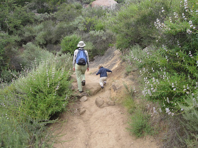
We left the East Bay hills, where unfortunately far too much eucalyptus is grown. I took Hilina with me on a father-daughter only hike in Anthony Chabot Regional Park. We did a loop hike along the ridgetop, but mostly what we saw was eucalyptus and occassional views.

Chabot Lake through the Eucalyptus


Hilina is already training to be a park ranger. She always wants us to tell her a story, but refuses to over tell her one herself. That changed when I put her on stage and told her she was a ranger. Here she is telling me a story about a baby turkey that is going to be eaten by a mountain lion and then the mama and papa turkeys come to the rescue.

April 21, 2010

California Academy of Sciences in San Francisco


Yesterday on the rainy day, we headed into San Francisco to visit the Cal Academy of Sciences. This "super" museum bills itself as four in one. It contains an aquarium, a "rainforest", a natural history museum, and a planetarium.


The place is very popular and was filled with (and I am not exaggerating) thousands of school kids on field trips. These crowds of out of control kids did take away from the experience and made it a bit tough to soak it all in. We'd love to return one day on a quieter day.


Nonetheless, Hilina had a great time as usual. There were exhibits on evolution and the work the academy does in the Galapagos and Madagascar on adaptation and endemism. There was a special African exhibit showing the various ecosystems of the continent.


There was a special "extreme mammals" exhibit showing the amazing variation in size and shape of mammals throughout time. The aquarium had sections on the California coast, the Philippine corals reefs, southeastern freshwater swamps (with alligators and snapping turtles), and rare or usual fish (including lungfish).


The rainforest is sealed in a large plexiglass ball with lots of butterflies. One of them found Hilina's finger.


The living roof was interesting. It apparently traps 98% of all rainfall. Since it absorbs sunlight in the leaves, it keeps the museum cooler in summer (saving on air conditioning costs). It also provides insulation in winter. Surrounding it were solar cells to supply energy to the building. It is made up of all California native plants and has become a haven for a variety of birds and insects including an endangered butterfly who's habitat in the Bay Area has disappeared due to development.

April 19, 2010

Back in the East Bay


After spend a few days in Santa Cruz visiting friends, we are now at Anthony Chabot Regional Park in the hills east of Oakland for the week. We are meeting our friends from Reno in Calistoga on Friday, so this was a good intermediate location to settle for the week.


A big rain storm is expected Tuesday and into Wednesday, so we used our Monday to do a nice loop in the hills of the East Bay before hand.

The first part of the loop follows Redwood Creek up the valley. Yes, it is lined with Redwoods. This creek was apparently the descriptor location for the first rainbow trout. In addition, it had gigantic redwoods, apparently some of the largest of all time, that were cut in the 1840's to build Oakland and the large trees today are their 2nd growth resprouts.


On the ridgeline, the views unfortunately were obscured by too much brush and small trees, but there were glimpses of the East Bay mountains including Mount Diablo.


During the storm, we are going to San Francisco to visit the natural history museum on Tuesday and then on Wednesday to Richmond to see Rosie the Riverter National Historic Park and to celebrate Linda's birthday in Berkeley.


April 16, 2010

The Big Sur


We have moved onto Santa Cruz to visit with some friends. But, we spent the last 3 days in the Big Sur. We've come to a few conclusions about the area though...


1) We definitely need to come back. We simply did not have enough time to adequately explore the area.


2) We saw more poison oak than anywhere else we have ever been. We went down a trailed we called "Poison Oakville" because the trail crew had not hit it. It was covered all along the sides and overhanging and it was quite the contorsionist maneuvers to have gotten through it without contact.

This is Mount Manuel Trail climbing 3000 feet up. We'll do that next time.

So, we'll be better prepared next year in terms of timing, plans, and poison oak protection. There is so much to see in Central California.

Pfeiffer Beach

Can you see the sea otters in the cove below?

A closeup

The situation was simply we did not have enough days due to weather and timing of meeting people, plus some meetings I had. But, we'll be back to this beautiful landscape.

How would you like that Italian-style villa overlooking Point Lobos?

April 14, 2010

Big Sur Coast and Elephant Seals


Yesterday we drove 90 miles up the coast to Pfeiffer Big Sur State Park. Along the way, we stopped by Elephant Seal Beach. It is one of the only places where Northern Elephant Seals breed and haul out along the mainland coast. Mostly they rely on offshore islands.


They rotate to this beach several times per year, depending on the activity. At this time, it was all females and newborns, while all the giant males are up in Alaska feeding. The females are molting. Once they are done, they too will head to Alaska.

The females and youngsters do not have those long noses.

The newborns are still learning how to swim and forage. They have already weaned and will head to Alaska in the new couple of months once they master swimming in the open ocean and can catch fish.

Rugged Coast and rocks stained white by seabirds


Afterwards, we headed up the Big Sur coast. Upon arrival at Pfeiffer Big Sur SP, we did a short 2 mile trail up through the redwoods and to the valley overlook and Pfeiffer Falls. We were surprised to come across these dense redwoods already this far south.

Redwoods charred by the 2008 fires. Notice the resprouting from the base.

As it turns out, Big Sur is the southernmost area of redwoods. They live in the deep canyons and valleys of the mountains. But, quicky above them the habitat transitions to chaparral and grasslands. We'll venture above the redwoods later today on a hike called Buzzer's Roost.

Hilina gets really excited when there are stairs

Pfeiffer Falls

April 11, 2010

Bishop Peak near San Luis Obispo on a cloudy day


This is a quicky post while I do laundry on a windy and rainy Sunday in San Luis Obispo. The big storm arriving meant we decided to keep it simple today. We did a quick 2 mile hike to Eagle Rock at the El Chorro Regional Park, where we are camping. As I'll show in a future post, on a cloudy, drizzly, and windy day, it didn't look too different than our May trip to Northern England or our multiple trips to Ireland.


Yesterday, as the clouds built up and the temperatures dropped, we decided to stay local and do the 3 mile round trip to the summit of Bishop Peak. One of the famed "Nine Morros", this one is right in town and offers views of San Luis Obispo, California Polytechnic University (known locally as Cal Poly), and the grassy landscape around it.


The trail is very popular with the college kids and locals and many people were not dressed in traditional hiking gear. But, despite it's short distance, it is a real hike. It climbs over 1,000 feet and it quite steep and rocky in several places. In addition, you need to watch out for poison oak hanging over the trail in a few places.


The mountain is called Bishop Peak because of the three rock formations at the summit that were said to resemble a Bishop's hat (although I didn't see it). Anyways, we saw several rock climbers with ropes playing around at the summit.

The view of the campus of Cal Poly (see the letter P on the hill?)

April 9, 2010

Montana de Oro State Park near Morro Bay


Today we did a nice trip over to Montana de Oro State Park near Morro Bay. It is one of the largest state parks in California, consisting mostly of steep coastal bluffs, coastal sage scrub, grassland, and several large stands of invasive eucalyptus trees amongst a series of ridges and mountains. The day started out foggy, so we waited until 10am to head out. By the time we got there, the sun was out for a beautiful, if not somewhat hazy day.

Valencia Peak (1350 feet) from the shore

The main thing we did today was the 4 mile round trip up to the summit of 1350 foot Valencia Peak. It is a steep, if not long hike, with towering views across the coastline and sea. I will discuss this hike in more detail in a Hikemasters' Trail Description post in the coming days. But, it was a great way to get a workout.


Afterward returning from the summit, we simply crossed the street from the parking area and hiked out to the coastal bluffs that stand 50 feet or so above the surf. The wave action was strong due to an impending storm arriving Sunday. But, it was low tide, so alot of the steeply tilted sedimentary layers were visible.


We hiked about a mile out to a place called Corralina Cove, where some nice tidepools were there to explore. I wouldn't call them Washington coast quality pools, but Hilina was jumping around the rocks catching hermit crabs, touching sea stars and sea anemonies, and just having a wonderful time overall.


All along the beach were these gooey clumps of natural asphalt that originate as tar seeps in the Santa Barbara Channel and float around on the ocean and wash up on shore. This is the same material as in the La Brea Tar Pits. Basically, it is crude oil where all the volatile chemicals like methane and kerosene have evaporated out of it. It is generally harmless, but sticky to get off your hands.

April 6, 2010

Santa Ynez Mountains and Turkey Vultures

Lake Cachuma in the distance below the Santa Ynez Mountains

We have moved our operations to San Luis Obispo for the remainder of the week. But, with the clouds breaking and the sun returning, we decided to take a quick trip up to the summit of the Santa Ynez Mountains to see the spectacular views before breaking camp at Lake Cachuma and heading north.


We drove up the Camino Cielo (Heaven Road) which is a narrow winding road along the summit ridge of the Santa Ynez range. From this road, there are views both south across the Pacific Ocean to the Channel Islands and north across the Santa Ynez Valley and to the San Rafael Mountains.


We took a short 1 mile roundtrip stroll to Knapp's Castle, an early 20th century lodge that was built on the ridge above the Santa Ynez Valley that burned down in the 1940's. Today, all that remains are the concrete foundations and old chimneys.


Funny thing is given the chaparral habitat around it and the ruins, it reminded us of hundreds of old ruins we'd seen in Italy and elsewhere in Europe, but just a few centuries younger.


Last night was also an interesting and educational opportunity for Hilina as four turkey vultures descended down to the field behind our campsite. Hilina and I walked up to them to see what they were up to. It was probably the closest she'd ever gotten to a turkey vulture that wasn't flying, just feet away before they relunctantly flew off.


Eventually, we found the dead squirrel they were working on. It was an educational experience to explain to her the cycle of life, that animals get old and eventually die, but that it helps to give food to vultures and other scavengers that eat them. She seemed fine with the concept and later Linda used that opportunity to explain that is what happened to Maile.